A few weekends ago, when the weather in California’s Napa Valley was still chilly but the skies were blue and spring no longer seemed as distant as eternity, I announced to my family that we were going on a walk (being a Brit, I reserve the word “hike” for something more rigorous). Getting a tween and a teen out of bed on a Sunday morning is no mean feat, but with 24 hours’ notice and the lure of breakfast in Calistoga, no one groaned at the idea.
Sundays used to be reserved for family walks when we lived in the city, whether across town or in the Marin County headlands. Ironically when we moved to the Napa Valley and started spending more time outdoors, our weekly walks went by the way side. I had had my eye on this Calistoga road for a while, and wintry white skies yielding to a bright blue one was all I needed to make this happen.
To follow our route, see below for directions to Old Lawley Toll Road, just north of Calistoga.
iPhone Photos by Sarah Lonsdale for Remodelista.

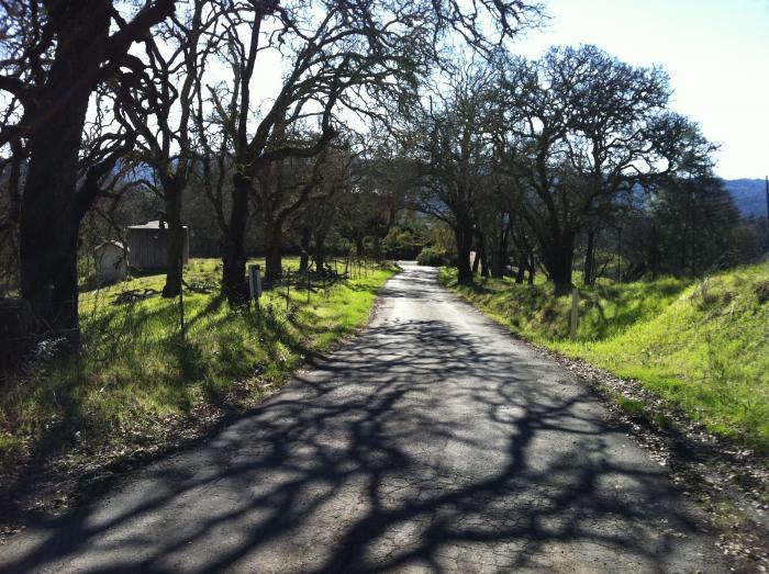
Above: The walk is a slow ascent up Old Toll Road. That said, we only saw one car the entire time we were walking. The biggest hazard we encountered was three Lycra-clad cyclists who came round a corner at great speed on a steep incline (rather impressive in hindsight).

Above: Vineyard views; these are terraced, quite unusual in the Napa Valley.

Above: The Old Toll Road used to be the only way to traverse Mount St. Helena to get to the Lake County resorts.

Above: In the distance, Mount St. Helena (another option for a hike).

Above: Cactus in bloom along the side of the road.

Above: In the distance, the cliff faces of the Palisades. The Palisades Trail is one of the most scenic in the Valley; with panoramic views, it runs around ten miles from Mount St. Helena down to Oat Hill Mine Road in Calistoga. (We did it one Easter Sunday and our children announced that they wished they could just have gone to church like everyone else.)

Above: The red bark of a manzanita tree.

Above: The road ascends with twists and turns, with views disappearing from time to time.

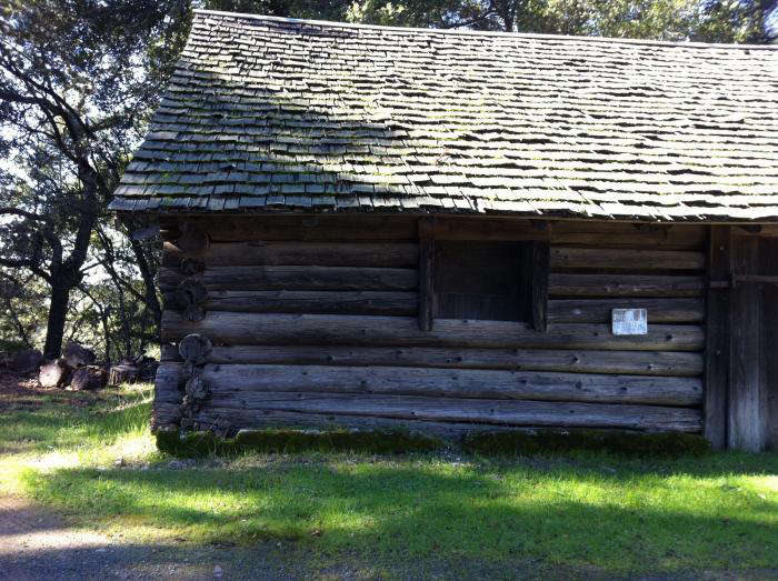
Above: Towards the top of the road is an historic cabin.

Above: We turned around at this point but the Old Lawley Toll Road eventually joins with the main route heading over the mountain to Middletown, and it’s possible to park a car at the top and do the walk in reverse.

Above: Another great view of the Paiisades as we head downhill.

Above: An easy amble downhill. The added bonus of this walk is the two wineries at the bottom, Jericho Canyon and Amici Cellars. Both require advance reservations to visit, so call ahead.

Above: Old Lawley Toll Road, just north of Calistoga. Map via Google.
Directions: Head north on the Silverado Trail, continuing beyond Calistoga on the Robert Louis Stevenson Historic Trail to Silverado toward Middletown. Before the road begins to climb, turn right onto Old Toll Road, also known as Old Lawley Toll Road. Head along the road until you cross a tiny bridge (after Jericho Canyon winery ) and the road begins to climb; find a place to park.
For another of our favorite Bay Area routes, see Hike of the Week: San Francisco’s Best Kept Secret.
Looking for some more walks? See our Hike of the Week and Garden Visits.
Explore More: Garden Visits.


Have a Question or Comment About This Post?
Join the conversation (11)